At 11:40 on Dec. 28, Wenzhou Municipal Meteorological Observatory released blue warning signal of cold wave!
The Wenzhou Municipal Meteorological Observatory released an important weather forecast:
▲From the evening of the 29th, a strong cold air from north to south will affect Wenzhou, and the temperature will drop sharply. From the night of the 29th to the morning of the 30th, there will be sleet or snow in the western mountainous area of Wenzhou.
▲The average temperature is expected to drop by more than 10℃ in most areas in 48 hours (29th-31st).
▲The lowest temperature will appear on the morning of Dec. 31-Jan. 1, the urban and plain areas will be -2℃ to -4℃ with freezing.
▲The lowest temperature in western mountainous areas will be-4 to -6 ℃ with freezing or severe freezing; in high mountain areas can reach -6 ℃ with severe freezing. The scale of drop in temperature in most parts of Wenzhou has reached the cold wave standard.
▲From the night of the 29th to the 31st, there will be northerly gale wind of magnitude 9-11 and 6-8 on the coastal sea and inland plains respectively.
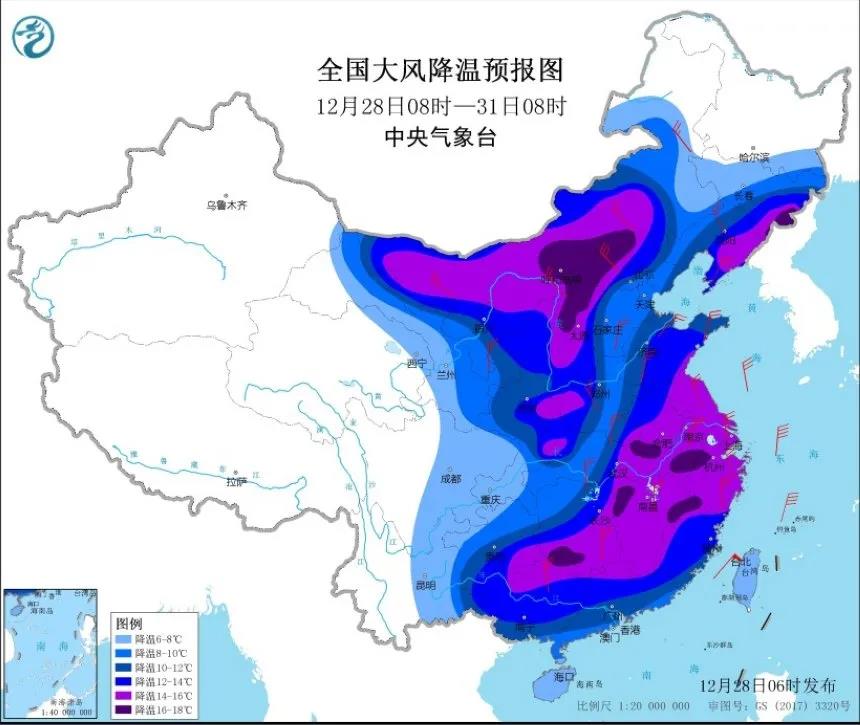 (National forecast map of gale wind and temperature-drop)
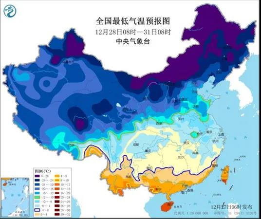
(National forecast map of minimum temperature)
Weather forecast:
Dec. 29 (Tuesday): Cloudy to overcast 11~21℃
Dec. 30 (Wednesday): Cloudy to sunny 4~9℃
Dec. 31 (Thursday): Sunny to cloudy -3~7℃
Jan.1 (Friday): Sunny to cloudy -2~8℃
Jan.2 (Saturday): Sunny to cloudy 0~12℃
The cold wave is raging, everyone must pay attention to keep warm!
If you plan to go out on New Year's Day holiday, please dress warmly and do personal protection!
The article is from WeChat Official Account "Wenzhou Lucheng Release"